


Welcome to Skylark Bhutan: Your Gateway to Happiness in the Land of the Thunder Dragon
Embark on an extraordinary journey to the enchanting realm of Bhutan, where happiness is not just a concept, but a way of life. Skylark Bhutan, a premier travel company, invites you to experience the wonders of this mystical land nestled in the Himalayas. Let us take you on a transformative voyage, where awe-inspiring landscapes, vibrant traditions, and warm-hearted people will leave an indelible mark on your soul.
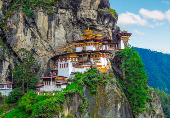
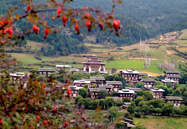
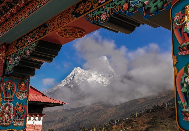
Whether you're an intrepid adventurer or a soul in search of tranquility, Skylark Bhutan has the perfect journey that aligns with your passions. Picture yourself standing at the iconic Tiger's Nest Monastery, feeling the profound spirituality that surrounds you. Or perhaps you dream of hiking through pristine forests and encountering rare wildlife at every turn. Whatever your heart desires, Bhutan has it all, and we have the key to unlock its wonders for you.
Our itineraries are meticulously crafted, incorporating both iconic landmarks and hidden gems, to ensure you don't miss a single moment of Bhutan's charm. As you explore, you'll be embraced by the captivating blend of tradition and modernity that sets Bhutan apart.
Why Choose Skylark Bhutan?


Expertise and Authenticity
With years of experience and an unwavering commitment to excellence, Skylark Bhutan is your passport to an authentic Bhutanese experience. We are a team of passionate explorers who have ventured deep into Bhutan's heart to handpick the most captivating destinations and hidden gems.

Tailored Journeys
Your desires and aspirations are at the heart of every trip we design. Whether you seek adrenaline-pumping treks through verdant valleys or serene meditations amidst ancient monasteries, our bespoke itineraries cater to your individual preferences.

Local Connections
Embrace the true essence of Bhutan by forging connections with its warm and welcoming people. Our local guides, born and raised in Bhutan, are eager to share their profound knowledge and captivating tales, creating meaningful connections and unforgettable memories.
Responsible Travel
At Skylark Bhutan, we believe in sustainable tourism. Our commitment to preserving Bhutan's pristine beauty goes hand in hand with supporting local communities. We ensure our trips are eco-friendly, leaving no negative impact on the environment or the cultural heritage of this sacred land.

Safety and Comfort
Your safety and comfort are our utmost priorities. From handpicked accommodations with stunning views to reliable transport, we ensure a seamless journey, leaving you free to bask in the joy of exploration.